La Fière Bridge & Causeway
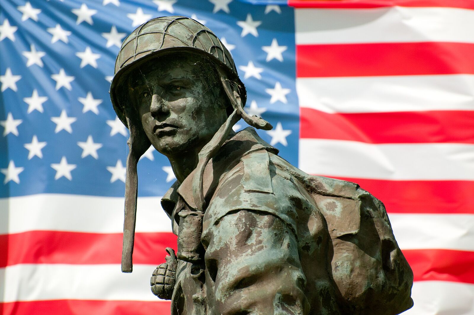
Scene of fierce fighting from 6 to 9 June 1944 as American paratroopers battled to hold a vital bridge and causeway over the flooded Merderet river west of Sainte-Mère-Église. The Iron Mike statue now honours the airborne troops who fought one of their costliest actions here.
A few kilometres west of Sainte-Mère-Église, a narrow stone bridge carries a country lane over the sluggish Merderet. It looks like nothing at all. Yet in June 1944 this crossing, and the raised causeway running dead-straight beyond it, became one of the most desperately contested pieces of ground in Normandy - a place a historian of the airborne later called "probably the bloodiest small unit struggle in the experience of American arms."
Why a Ditch-Water Bridge Mattered
The Germans had opened the sluices at the coast and let the sea back up the Merderet and Douve valleys, turning the low meadows into a shallow lake screened by tall grass. To paratroopers drifting down in the dark on 6 June, ground that looked like firm pasture was often waist-deep water; many drowned under their equipment. That same flooding made the La Fière bridge and its long, exposed causeway the only dry road across the marsh - and therefore the hinge between the airborne troops inland and the men coming ashore at Utah Beach. Whoever held it controlled the western flank of the invasion.
Four Days on the Merderet
On D-Day a scratch force of the 82nd Airborne - men of the 505th, 507th and 508th Parachute Infantry Regiments, scattered far from their drop zones - fought their way to the eastern bank and took the manor and bridge. Late that afternoon German infantry and a handful of captured French tanks counterattacked down the causeway. Two paratroopers, Lenold Peterson and Marcus Heim, stood in the open with a bazooka and knocked out the leading tanks at point-blank range; Heim reloading while shells burst around them. "Why we were not injured or killed," he said afterwards, "only the good Lord knows."
The Germans were stopped, but a bridgehead pushed across to the hamlet of Cauquigny on the far bank was overrun, survivors wading back through the marsh. For three days the two sides shelled and shot at each other across a few hundred metres of water. When told to hold at all costs, Lieutenant John "Red Dog" Dolan of the 505th replied that there was no need for further orders: "I know of no better spot to die. We stay."
The deadlock broke on 9 June. General James Gavin ordered a frontal charge straight down the causeway, led by glider infantrymen. Captain John Sauls shouted "Follow me!" and ran into a wall of fire; the men behind him crossed a road already carpeted with the dead. Roughly thirty-five Americans were killed on the causeway that single morning, but the far bank was taken and held, and the road west was finally open.
What to See Today
The bridge and causeway survive almost unchanged, and their tactical logic is instantly legible from the ground. Stand on the bridge, look west, and you see exactly what the assault troops saw: a straight, raised ribbon of road with no cover at all, the old floodplain falling away on either side. It is worth walking a little way out onto it to feel how naked the crossing was.
Above the bridge stands Iron Mike, a bronze paratrooper gazing out over the fields - a replica of the "Airborne Trooper" figure at Fort Bragg, unveiled here in 1997. The plaques around its base honour the 82nd Airborne and its commander, James Gavin. Behind it the Manoir de la Fière, the stone farm that anchored the American line, still stands on rising ground east of the water.
At the western end, a short drive round, the little chapel of Cauquigny marks the far side of the fight, its walls patched where the war left its marks. The site has little formal signage, so it rewards a visitor who already knows the story; the Airborne Museum in nearby Sainte-Mère-Église fills in the wider picture. Come early or late, when the fields are quiet, and the flatness of the ground tells the rest.
Practical notes
The site lies on the D15 a couple of minutes west of Sainte-Mère-Église, and it is unmistakable once you are on it: the bridge, the rising ground with Iron Mike above it, and the dead-straight causeway running west. There is a car park by the memorial, and the ground is open access and free at any hour. Cauquigny, at the far end, is reached by road round the marsh rather than along the causeway.
Allow an hour. That is enough to take in the memorial, walk out along the causeway far enough to feel the exposure, and drive round to the chapel.
The car park and the paved apron around Iron Mike are level and firm, and the causeway itself is a surfaced lane, so the essential views are reachable with a wheelchair or a pushchair. It is a live road, though narrow and lightly used, so listen for cars. The slope up to the memorial from the water is short but noticeable, and the field edges and old floodplain either side are rough, tussocky and wet underfoot for much of the year, so stay on the tarmac unless you have boots. The natural pairing is Sainte-Mère-Église and its museum in one direction and the other contested crossing at Chef-du-Pont, a few minutes south, in the other.