Falaise
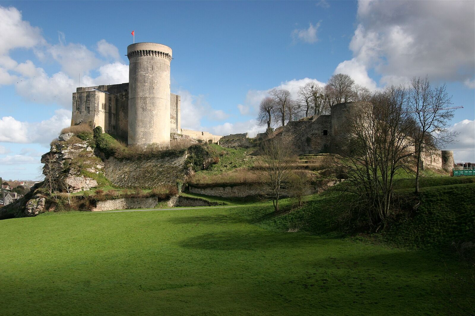
Birthplace of William the Conqueror, this castle town gave its name to the Falaise Pocket, where the Battle of Normandy was decided in August 1944. The Mémorial des Civils dans la Guerre here is devoted to the experience of French civilians under occupation and battle.
Falaise wears two histories at once. It is the town where William the Conqueror was born around 1028, a fortress settlement whose very name means "cliff" - and it is the place that lent its name to the Falaise Pocket, the trap that closed in August 1944 and finished the Battle of Normandy. A visitor who comes only for the castle will miss half the story; one who comes only for the war will walk past a thousand years of it.
The medieval town
The Château de Falaise rises on a rocky spur above the Ante valley, a great pale keep that was the seat of the dukes of Normandy. This is the reputed birthplace of William, son of Duke Robert and Herleva, a local woman of modest birth - a parentage that earned him the name "William the Bastard" long before he became the Conqueror. In the market square below, the Place Guillaume-le-Conquérant, stands Louis Rochet's bronze equestrian statue of William, unveiled in 1851. Look at the base: six smaller figures added later represent the first dukes of Normandy, from Rollo the Viking down to William's father Robert. The nearby church of Saint-Gervais-et-Saint-Protais carries Norman work begun in the generation after 1066.
What happened here in 1944
By early August 1944 the Allies had broken out of the beachhead, and the German armies in Normandy were being funnelled into a shrinking pocket of country between Falaise in the north and Argentan in the south. Canadian and Polish forces pressed down from the Caen direction while American and Free French units pushed up from the south; the aim was to seal the two jaws shut and trap what remained of two German field armies inside.
Falaise itself was taken by Canadian troops in mid-August after fierce street fighting, but not before Allied bombing had flattened much of it - roughly two-thirds of the town was destroyed. The decisive killing ground lay a little to the east, in the narrowing corridor around Chambois and the ridge of Mont-Ormel, where German columns funnelled through the last open gap under relentless fire. Tens of thousands of German soldiers were killed or captured; the roads were left choked with wrecked vehicles and dead horses. Eisenhower, walking the battlefield afterwards, described a scene that could only be described by stepping over the dead. The battle broke the German army in the West and opened the road to the Seine and Paris.
What to see today
The town you walk through is largely rebuilt, its stone squares and long views the product of postwar reconstruction rather than survival. The essential stop is the Mémorial des Civils dans la Guerre on the Place Guillaume-le-Conquérant, opened in 2016 and unusual among Normandy's museums for turning the lens away from soldiers. Across its exhibition floor it follows ordinary French people through occupation, rationing, resistance, denunciation and persecution, then through the terror of the bombing, the exodus along the roads, and the grinding work of rebuilding a ruined town. An immersive film recreates the experience of being beneath aerial bombardment - a reminder that the roughly twenty thousand French civilians killed in the Battle of Normandy are the least-visited casualties of the campaign.
From Falaise, the battlefield opens outward. Drive east toward Chambois and up to the Mémorial de Montormel, set on the ridge the Poles held while the pocket was sealed; from its terrace you look straight down into the "corridor of death," and the ground reads almost as clearly as a map. Back in town, climb to the château for the wider view: the same commanding position that made Falaise a ducal stronghold made it, nine centuries later, a place worth destroying to capture. Standing on the ramparts, the medieval town and the 1944 battlefield resolve into a single landscape.
Practical notes
Falaise is straightforward to reach, half an hour down the N158 from Caen, and there is parking around the Place Guillaume-le-Conquérant and below the château. Both the civilians' memorial and the castle are ticketed and stand within a couple of minutes' walk of each other, which makes the square the natural place to leave the car for the whole visit.
Allow half a day for the town: a good ninety minutes or more inside the Mémorial des Civils, and a similar stretch for the château if you go up. The old streets slope, and the walk from the square up to the castle entrance is a steady climb on pavement and cobbles. The museum itself is modern and level inside, but the keep is a medieval building of spiral stairs, narrow doorways and uneven floors, and the ramparts walk is not a pushchair route; the courtyard and the view from outside the keep are reachable without the stairs.
If you are following the closing of the pocket, keep the afternoon for the ground east of town: Trun and the corridor beyond it lead directly to the ridge, and the drive is short. Coming from the other direction, the Bretteville-sur-Laize Canadian War Cemetery lies beside the road up to Caen and holds many of the men who died forcing the way here.