Chambois
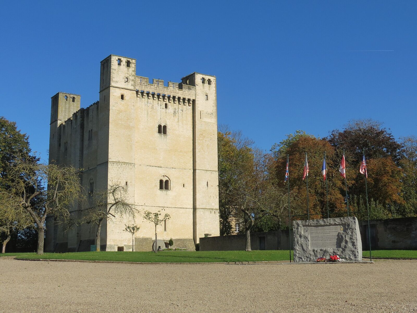
A village where Polish, American and Canadian forces linked up on 19 August 1944 to seal the Falaise Pocket, trapping much of the German Seventh Army. The nearby heights of Mont Ormel saw the desperate final battle to hold the trap shut.
For most of the Battle of Normandy, Chambois was an unremarkable farming village in the valley of the Dives, notable only for a stone tower that had watched over the river crossing for eight centuries. For two days in August 1944 it became the cork in a bottle holding tens of thousands of German soldiers, and the place where four Allied armies finally shook hands.
The trap closes
By the third week of August 1944, the German armies in Normandy were being squeezed into a shrinking pocket around Falaise. Their only escape lay eastward, through a narrowing gap of country roads and river fords between Trun and Chambois, of which the village guarded one of the most important. Closing that gap fell to a converging set of forces: the Polish 1st Armoured Division pushing down from the north, the American 90th Infantry Division coming up from the south, with Canadian and French armoured units driving into the same few square miles.
On 19 August the jaws met in the village itself. In the streets around the old keep, Polish soldiers of the 10th Dragoons linked up with American infantry of the 90th Division, and the escape route was cut. What followed was not a clean victory but two days of chaotic, close-quarters fighting as remnants of the German Seventh Army threw themselves at the thinly held village, desperate to break back through. The defenders held, and thousands of Germans were taken prisoner in and around Chambois.
The Polish commander, General Stanisław Maczek, remembered the meeting with warmth rather than triumph. His men, he wrote, were greeted by the Americans "with the joy of a child," their pockets stuffed with candy and cigarettes; one GI of Polish descent sought him out simply to speak, in the halting Polish of his parents, to a Polish general.
The Mace above the village
The seal was not truly secure until the heights just east of Chambois were held. There, on Hill 262 - a long ridge the Poles nicknamed "the Mace" (Maczuga) for its shape on the map - a battlegroup of the Polish 1st Armoured Division dug in astride the last German escape corridor and endured relentless assault from both sides at once: units trying to break out from within the pocket, and SS armour attacking from outside to prise it open. Cut off and running low on ammunition, the Poles held the ridge until relieved. It was one of the costliest and most decisive stands of the entire Normandy campaign.
What to see today
Chambois rewards an unhurried visit. At its heart stands the 12th-century Norman keep, a rare surviving square donjon, still dominating the crossroads as it did when the fighting swirled around its base. Nearby, at the junction of streets now named Rue des Polonais and Rue des Canadiens, a stone memorial marks the closing of the pocket; its inscription recalls the fortress that has guarded the Dives crossing since the Middle Ages and the armies - American, British, Canadian, Polish and French - that met here in 1944. Look for the plaque honouring Captain Waters of the American 359th Regiment and Colonel Zgorzelski of the Polish 10th Dragoons, the two officers whose units linked up here; both returned in 1965 and were made honorary citizens of the village.
The story only makes full sense from higher ground. Drive the few kilometres northeast to the Montormel Memorial, set on the ridge of Hill 262 itself. From the terrace the whole battlefield opens out below you - the valley, the villages, the corridor through which the German army tried to escape - and a striking metal sculpture splits an exploding shell into four points, one for each of the Allied nations that closed the trap. Inside, an animated map and a panorama walk you through the two days that ended the Battle of Normandy on this quiet Norman hillside.
Practical notes
Chambois lies well inland of the invasion beaches, in the Dives valley south-east of Caen and a little under an hour's drive from it on quiet country roads. It is a small village with no visitor car park; there is room to leave a car near the keep and the memorial at the crossroads, and everything worth seeing stands within a few minutes' walk. The keep and the memorial are open ground and free to approach.
Half an hour covers the village itself, though most people fold it into a half-day circuit of the pocket. The streets are level and paved and the memorial sits at the roadside, so it suits a wheelchair or a pushchair; the ground immediately around the keep is rough grass, and there is no pavement on every approach, so watch for farm traffic at the junction.
None of it makes full sense without the high ground, so pair the village with the Montormel Memorial on the ridge above, which is a short drive and turns the crossroads below into a battlefield you can read.