Picauville
A Cotentin commune that held a Luftwaffe airfield and was a drop zone for the US 82nd Airborne, whose paratroopers landed badly scattered across its flooded fields on D-Day. The village was fought over as American forces pushed west to cut off the peninsula.
Set among the low, water-meadow country between the Merderet and the Douve, Picauville looks today like any quiet Cotentin farming commune: a church, a scatter of hamlets, hedged fields that flood in a wet season. In June 1944 those flooded fields swallowed men and equipment whole, and the village sat squarely on the plans of both armies - a German divisional command post on one side, an American drop zone on the other. What unfolded here in the first hours of D-Day was less a set-piece battle than a confused, close-range struggle in the dark, and it produced one of the most storied episodes of the entire airborne assault.
The general who never reached his headquarters
Picauville was home to the headquarters of the German 91st Luftlande (Air-Landing) Infantry Division, installed at the Château de Bernaville just north of the village. On the night of the invasion the division's commander, Generalleutnant Wilhelm Falley, was away - he and other senior officers had been summoned to a war game at Rennes. Woken by the roar of aircraft and the reports of landings, Falley turned his staff car around and raced back through the darkness toward Bernaville.
He never arrived. On the country road near his own headquarters, his car ran into paratroopers of the 508th Parachute Infantry Regiment. In the firefight that followed Falley was killed, along with his adjutant. He is generally recorded as the first German general to die in the Battle of Normandy - struck down within sight of the château he was hurrying to reach, by the very troops whose landing had drawn him back. The officer usually credited with the shot, a lieutenant of the 508th, later described the encounter in vivid detail. Falley's body was eventually laid to rest at the German war cemetery at Orglandes, a few kilometres away.
Scattered across the flooded Douve
The airborne landing here went badly wrong from the start. Anti-aircraft fire broke up the transport formations, and the pilots released their sticks too high and too fast; men came down far from Drop Zone N, many of them into the flooded marshes, where the weight of their equipment could drown a heavily laden paratrooper in water only waist-deep. Only a fraction of the regiment assembled near its objective. Rather than an organised assault, the first hours became small knots of scattered men fighting to orient themselves, cut the roads, and survive. Others of the 508th were drawn east to the fight for the causeway at La Fière, a few kilometres away across the same marsh.
Picauville itself was not taken on D-Day. The village stayed in German hands for several more days while American forces regrouped and pushed west and south to seal off the Cotentin peninsula; it was cleared only after further fighting by infantry coming up from the direction of Chef-du-Pont. Once secured, the area's flat ground was put to immediate use: engineers laid out an advanced landing ground north-west of the town, operational within weeks as Airfield A-8, from which Thunderbolt fighters flew ground-attack missions over the beachhead through the summer.
What to see today
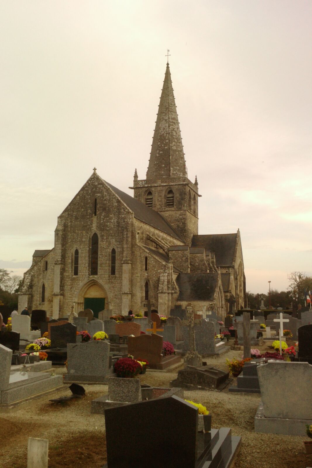
Picauville rewards visitors who come for the story rather than a museum. In the village, the church of Saint-Candide is the natural point of orientation. The Château de Bernaville, the German headquarters and the scene of Falley's death, lies to the north - but it is private property, so admire it from the public road and do not enter the grounds uninvited.
Two things reward a slower look. On the D69 toward Gourbesville, a stone cairn on the roadside marks the site of the wartime airfield, easily missed at speed. And in the fields where the paratroopers came down, the commune honoured veteran Zane Schlemmer of the 82nd Airborne with a marker and a road named rue Zane Schlemmer. Stand in these low, hedge-lined pastures and picture them under water in the pre-dawn dark, and the scale of what the scattered men faced becomes clear in a way no plaque can convey.
Practical notes
Picauville sits on the D70 west of the main north-south road through the Cotentin, and everything here is free and open air. Park in the village near the church, where there is room on the square, and walk the centre first; the outlying markers are a matter of driving slowly along the lanes and pulling in on the verge, so a map or a pinned location saves a good deal of doubling back.
Three quarters of an hour covers the village and the roadside stops, and rather more if you want to follow the lanes out toward Bernaville and the airfield cairn. The village streets are level and paved, and the markers can all be seen from a car, which makes this an easy stop for anyone with limited mobility; the verges themselves are grass, narrow and often soft, with no footway and fast traffic on the straighter stretches, so take care getting out.
Almost nobody comes to Picauville alone. It sits between the two great airborne set pieces of the Cotentin, so pair it with the causeway at La Fière and with Sainte-Mère-Église, whose Airborne Museum fills in everything the empty fields here leave unsaid.