Cherbourg
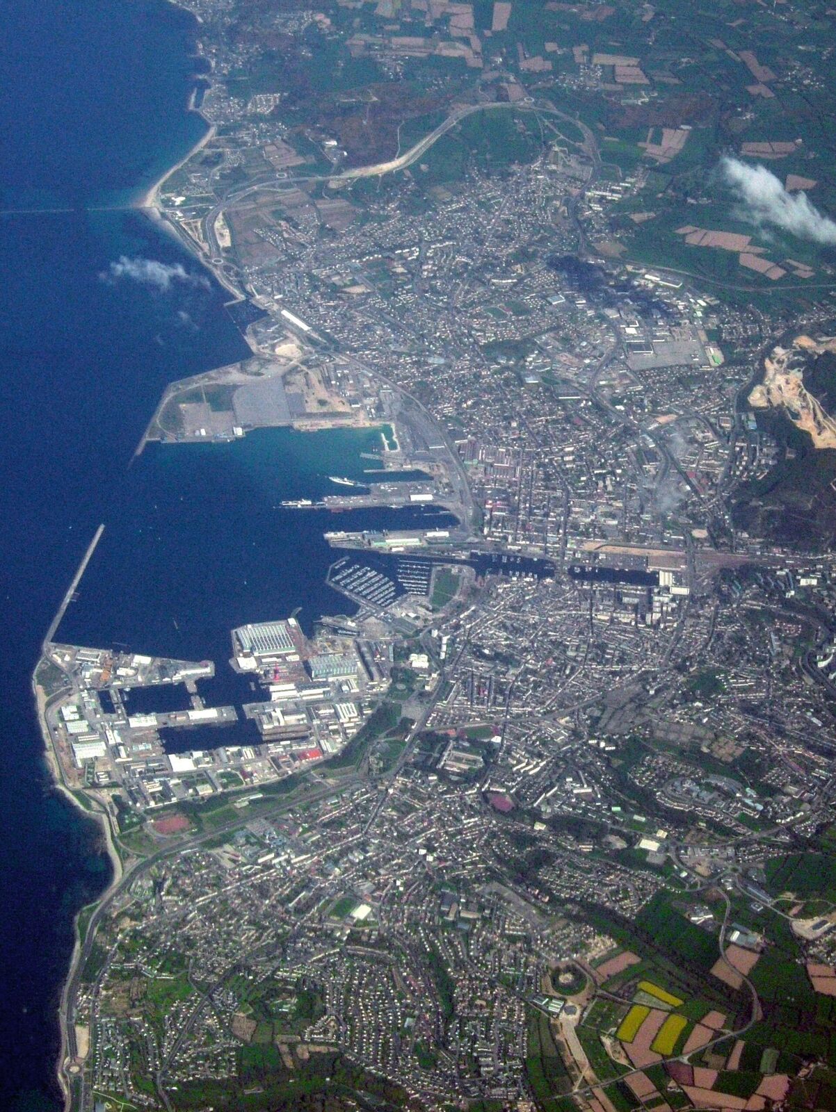
The deep-water port at the tip of the Cotentin was a prime Allied objective, captured on 26-29 June 1944 after the Germans had wrecked its harbour. Once cleared, Cherbourg became a vital supply gateway for the armies in France.
Standing at the top of the Cotentin peninsula, Cherbourg was never a landing beach - yet it was arguably the reason the beaches mattered. Allied planners knew that troops could be poured across open sand for only so long before an army needed a real harbour: deep water, cranes, rail links, somewhere to unload tanks and fuel through a Channel winter. Cherbourg was that harbour, and taking it was written into the invasion plan from the start.
The fight for the fortress port
After the landings, General J. Lawton Collins swung his VII Corps north, cutting the peninsula in two before driving on the city with three infantry divisions. By late June the Germans had pulled back into a ring of forts and concrete works ringing Cherbourg, defended by a garrison of mixed quality under Lieutenant General Karl-Wilhelm von Schlieben.
The hinge of the whole position was Fort du Roule, a 19th-century citadel cut into the rock of Mont Roule directly above the town, its guns able to sweep both the streets and the harbour. On 25 June the 79th Infantry Division's 314th Regiment fought its way up the slope under heavy fire, using Bangalore torpedoes to blast gaps in the wire. Two men earned the Medal of Honor here. Corporal John D. Kelly, unable to reach a pillbox any other way, repeatedly crawled up the exposed slope to place pole charges against it; Lieutenant Carlos Ogden went forward alone, wounded, to knock out an 88mm gun and machine-gun nests with rifle grenades. The bizarre situation was that Americans held the top of the fort while Germans still fought on from galleries tunnelled into the cliff beneath them.
Von Schlieben was captured on 26 June, but he surrendered himself, not the port. His naval counterpart had already overseen a methodical demolition so complete that Hitler awarded a decoration for a feat "unprecedented in the annals of coastal defence." Cranes were toppled, quays cratered, the harbour sown with mines and sunken ships. One of the war's stranger footnotes belongs to a small US Coast Guard reconnaissance party under Commander Quentin Walsh, which pushed into the naval arsenal, took the surrender of hundreds of Germans, and freed a group of American paratroopers being held prisoner there.
The port that fed the armies
Salvage crews and navy divers began clearing the harbour almost immediately, and it was a colossal job - one of the largest underwater demolition-clearance efforts of the war. Yet within weeks supplies were moving over the quays, and Cherbourg grew into one of the principal gateways feeding the Allied advance across France. It was here, too, that the first cross-Channel fuel pipeline of Operation PLUTO came ashore from the Isle of Wight, though that particular line proved troublesome and delivered less than hoped. The tonnage that flowed through the rebuilt port, more than the pipelines, is what kept the tanks rolling toward Germany.
What to see today
The obvious pilgrimage is Fort du Roule itself, reached by the aptly renamed Montée des Résistants that climbs Mont Roule. The fort now houses the Musée de la Libération, one of the oldest D-Day museums in Normandy, telling the story of occupation, resistance and liberation from the very ground the 314th fought over. Even without the exhibits, come for the position: from the terrace the whole vast artificial harbour - one of the largest in the world - lies spread out below, and you grasp instantly why both sides bled for this hill.
Down in the town, the quays and the great breakwaters are working port again, but the geography is unchanged; look across the roadstead and imagine it choked with wrecks. Walk the streets beneath the fort and you are on the ground the infantry cleared house by house. It is a place that rewards looking up - at the rock, the fort, and the guns that once commanded everything below.
Practical notes
Cherbourg is reached from the landing beaches by the N13, which runs the length of the Cotentin and takes roughly three quarters of an hour from Sainte-Mère-Église. In town, use one of the car parks near the port and the pleasure harbour and walk from there. For the fort, the Montée des Résistants winds up the hill by car to a small parking area at the top; walking up from the town is possible but it is a steep and unrewarding climb on roads. The quays, the breakwater views and the terrace are free to look at. The museum inside the fort is ticketed.
Allow two hours for the museum and the terrace together, or half a day if you also want the quays, the town centre and lunch by the water. This is the natural place to break a day at the northern end of the peninsula.
The waterfront is flat, paved and easy with a wheelchair or a pushchair. The fort is not: it is set on a rock above the town, the approach is steep, and the museum occupies a converted 19th-century casemate building with levels, thresholds and stairs. Check ahead if step-free access matters. Coming back south, the run down the N13 puts you within easy reach of Sainte-Mère-Église and Utah Beach, and the old ducal town of Valognes makes a quiet stop on the way.