Pointe du Hoc
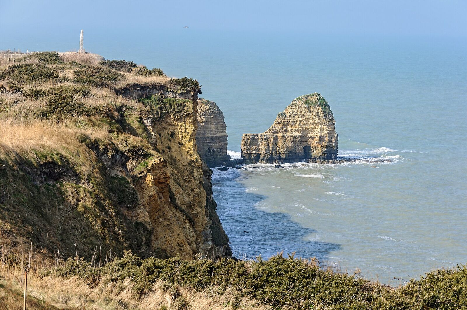
A 30-metre clifftop promontory between Utah and Omaha beaches, fortified by the Germans with a battery of 155 mm guns. On D-Day the US 2nd Ranger Battalion scaled the sheer cliffs under fire to neutralise the position. The cratered ground and shattered concrete bunkers survive largely as they were left in 1944.
Few battlefields in Normandy hit you as physically as this one. The ground itself is the exhibit: a cratered, buckled plateau of grass-grown shell holes and split concrete, ending abruptly at a sheer drop to the Channel. Stand at the cliff edge, look down at the shingle far below, then turn and look back at the maze of bunkers behind you, and the scale of what was asked here becomes uncomfortably clear.
Why the cliff mattered
Pointe du Hoc juts out roughly midway between what the Allies designated Utah and Omaha beaches. The Germans fortified the promontory with a coastal battery of six 155 mm guns - captured French pieces of First World War vintage - sited to sweep both landing areas from a single commanding position. Left intact on the morning of 6 June 1944, those guns could have raked the invasion beaches and the ships offshore. Neutralising them was judged worth an extraordinary gamble.
In the months before the invasion, aerial reconnaissance showed the Germans steadily withdrawing the guns as they upgraded the site with concrete casemates. When the assault force arrived, the emplacements were empty - a discovery that has fed the enduring myth that the whole operation was pointless. It was not. A patrol pushing inland found five of the guns concealed in a sunken lane behind the point, unmanned but fully serviceable, camouflaged and ready. The Rangers destroyed the firing mechanisms with thermite grenades. The mission succeeded, just not where anyone expected.
What happened here
The task fell to Rangers of the 2nd Battalion, under Lieutenant Colonel James Rudder. Landing craft carried them to the base of the cliffs, where launchers fired grapnel-tipped ropes up the rock face. The approach ran late and drifted off course, and by the time the boats grounded, casualties and swamped craft had already thinned the force badly. Under fire from above, the Rangers went up the ropes and mud-slicked cliff, reached the top, and fought through the shattered gun positions.
Taking the point was only the start. For two days the survivors held this exposed ground against repeated counterattacks by German infantry, cut off and desperately short of men, until relief finally reached them overland. Of roughly 225 who set out, only about 90 were still able to fight when it was over. They had been the first American unit to complete its D-Day objective.
What to see today
The site is open, free, and best given a couple of unhurried hours. A small visitor centre near the car park frames the story; from there paths lead out across the plateau.
Do not rush past the concrete. The bunkers, casemates, and troop shelters are largely as the war left them, and you can step down into several - low, damp, and blast-scarred. The craters are the other half of the story: the ground was pounded by naval guns and bombers before and after the landings, and the churned, overlapping pits give a visceral sense of that weight of fire.
Walk out to the seaward tip, where the German observation post and command bunker sits at the very edge. On top of it stands the Rangers' memorial - a simple dagger-shaped granite pylon, with inscribed tablets in French and English at its base. It was here, at this spot, that Ronald Reagan delivered his 1984 address to the surviving veterans, "the boys of Pointe du Hoc." Peer over the railings at the cliff to grasp what the climb meant.
A note for planners: the cliff is actively eroding and the point has been under long-term preservation work, so some paths and structures may be fenced or rerouted - walking routes are adapted to keep the site open. Stay behind the barriers; the drop is genuine and unguarded in places.
Practical notes
The point is reached from the D514 coast road, which runs between Grandcamp-Maisy to the west and the Omaha villages to the east; the turning is well signed and a short lane leads to a large free car park beside the visitor centre. Coaches use the same car park, so arriving early or late in the day makes for a very different visit.
Ninety minutes is the minimum here, and two hours is better if you want to go down into the bunkers and walk out to the seaward tip. The main path from the car park across the plateau is broad and firm, and a determined pusher could get a wheelchair or a pushchair along it as far as the memorial, but that is the limit: the ground either side is a mass of grassed-over craters with steep, uneven lips, and the bunkers are entered by narrow steps into dark, damp chambers. Wind off the Channel makes it feel colder than the inland sites, and there is little shelter once you leave the visitor centre.
The obvious pairing is Maisy Battery a few minutes down the road, which shows the gun positions the Germans kept working behind the coast, and the beach itself a quarter of an hour east, where the guns from this promontory would have reached.